41 LIBERTY DRIVE
Owner Information
CARNEY MARY ELLEN
41 LIBERTY DRIVE
PEMBROKE, MA 02359


Property Details
41 LIBERTY DRIVE is classified as a Residential Condominium (Condo-tnhs).
The primary structure on this property was built in 2004. There are 1966ft2 of built area within this property. There is 1966ft2 of residential/living space within this property. This property is listed as having 6 rooms.
41 LIBERTY DRIVE is valued at 445500. The land is valued at 0 and the structures are valued at 445500.
The most recent deed for 41 LIBERTY DRIVE is recorded at the local registrar in Book 31448, Page 170. 41 LIBERTY DRIVE was last sold on 2005-09-30 for 425000.
Assessment data from fiscal year 2022.
Flood Data
According to the FEMA National Flood Hazard Layer, this property does not appear to be in a flood zone. It may also be in an area not yet reviewed. Nonetheless, confirm this information prior to taking any action.
To view the flood hazards around this property, create a FEMA "Firmette" Map of the area around 41 LIBERTY DRIVE.
Broadband Internet Providers
| Provider | Type | Bandwidth (mbps) | |
|---|---|---|---|
| VSAT Systems, LLC. | Satellite | 2 | 1 |
| Viasat Inc | Satellite | 100 | 3 |
| Verizon New England Inc. | DSL | 5 | 0 |
| Comcast | Cable | 1000 | 35 |
| GCI Communication Corp. | Satellite | 0 | 0 |
| HughesNet | Satellite | 25 | 3 |
Broadband service provider data from December 2020.
Adjacent Properties
- 7 GROVE STREET
Single Family Residential owned by ZANSTUCK MICHELLE D. - 3 GROVE STREET
Single Family Residential owned by EDWARDS MELISSA A. - 41 QUEENSBROOK ROAD
Single Family Residential owned by PLEVOCK BRIAN MICHAEL - 47 QUEENSBROOK ROAD
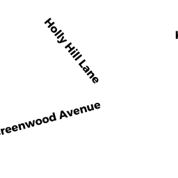
Single Family Residential owned by SULLIVAN JOHN J. - 29 GREENWOOD AVENUE
Single Family Residential owned by SMITH PETER D. - 33 GREENWOOD AVENUE
Single Family Residential owned by MOORHEAD ROBERT J. - 37 GREENWOOD AVENUE
Single Family Residential owned by ROBERT, N. CARLSON INVESTMENT TRUST - 21 GROVE STREET
Single Family Residential owned by PRENDERGAST ROBERT T. - 27 GROVE STREET
Single Family Residential owned by WILLIAM M. HARPER IRREVOCABLE TRUST - 0 CENTER STREET
Vacant, Selectmen or City Council (Municipal) owned by TOWN OF PEMBROKE - 41 GREENWOOD AVENUE
Single Family Residential owned by HENDRIX KAREN M. - 25 GREENWOOD AVENUE
Single Family Residential owned by MURPHY EDWARD - 11 GREENWOOD AVENUE
Single Family Residential owned by HIRSCH STEPHEN D. SR. - 15 GREENWOOD AVENUE
Single Family Residential owned by ALLEN SCOTT BRUCE - 21 GREENWOOD AVENUE
Single Family Residential owned by SMITH FAMILY LIVING TRUST - 223 CENTER STREET
General Office Buildings owned by TENNEY MOUNTAIN PARTNERSHIP - 5 GREENWOOD AVENUE
Single Family Residential owned by BERMAN DEBORAH L. - 257 CENTER STREET
Two-Family Residential owned by MCDONOUGH TIMOTHY M. - 15 QUEENSBROOK ROAD
Single Family Residential owned by DOYLE DAVID T. - 21 QUEENSBROOK ROAD
Single Family Residential owned by MCMORROW BARBARA A. - 27 QUEENSBROOK ROAD
Two-Family Residential owned by RICHARD G. AND CAROLINE A. O`DOWD REVOCABLE TRUST - 35 QUEENSBROOK ROAD
Single Family Residential owned by THE THIRTY FIVE QUEENS BROOK ROAD REALTY TRUST